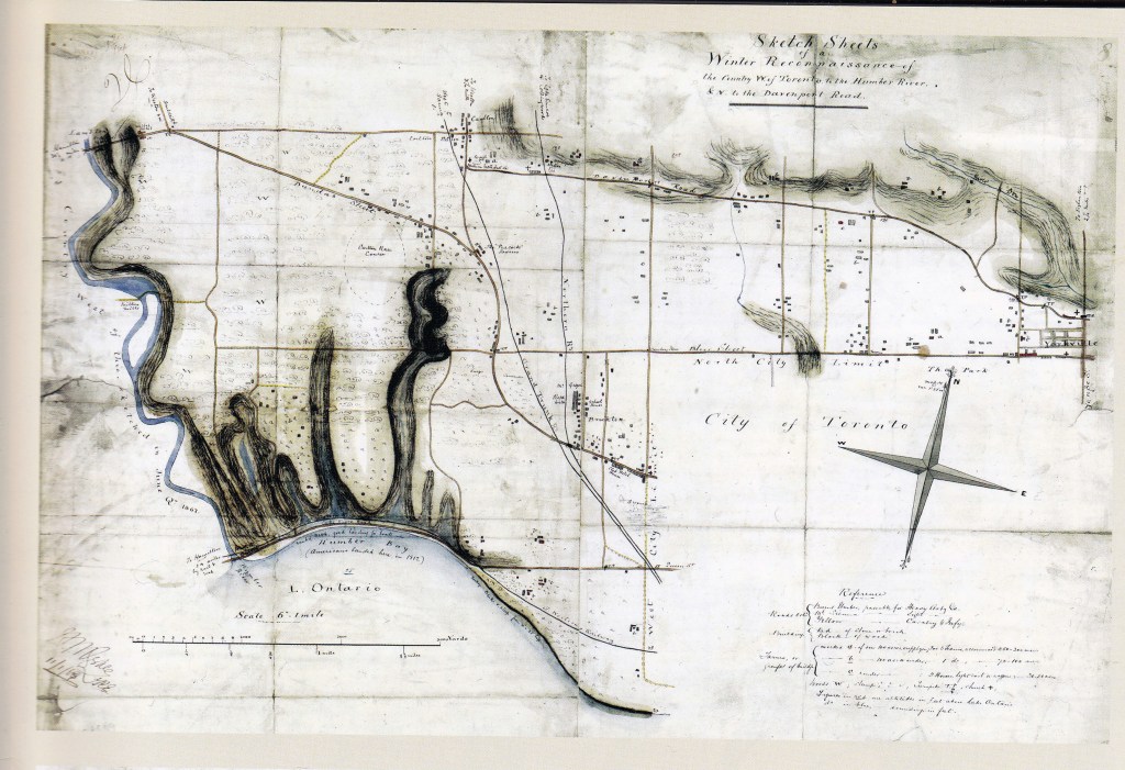
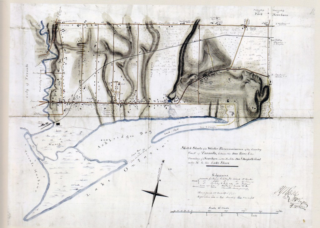
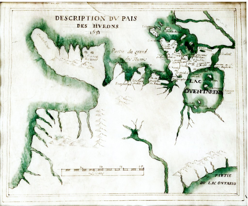
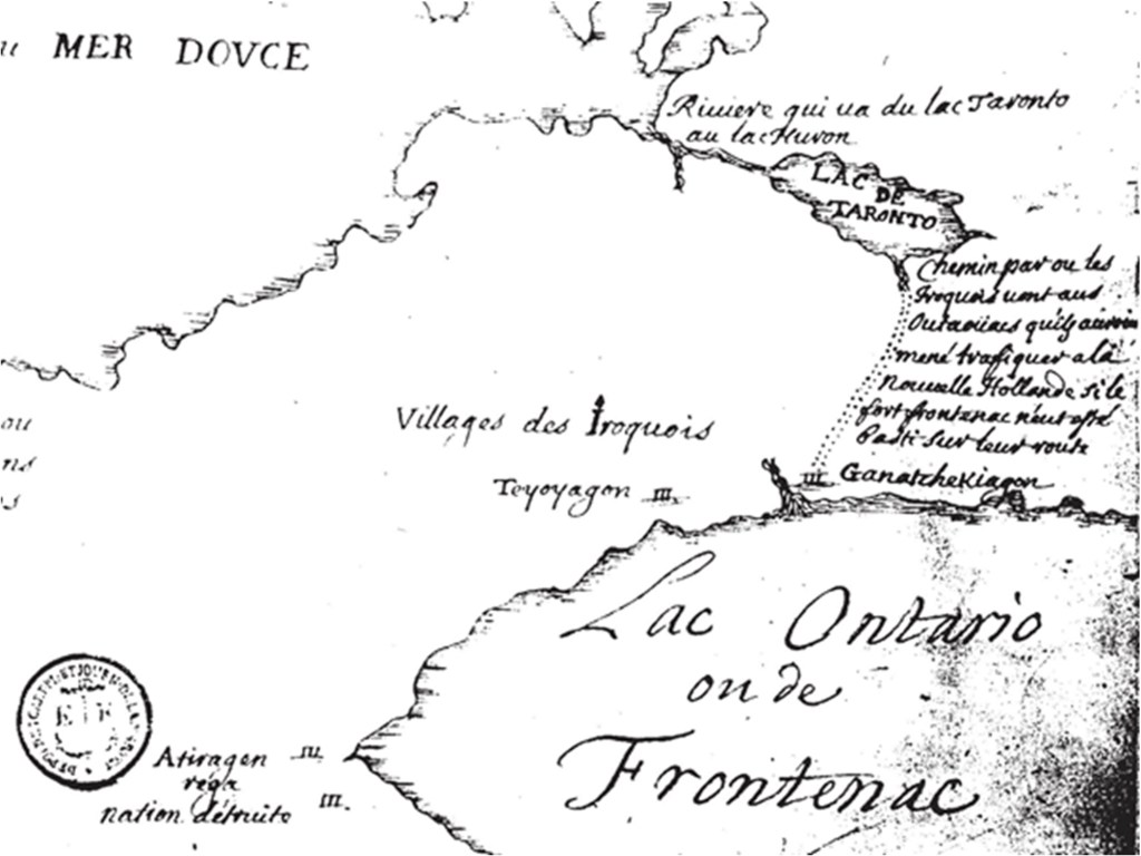
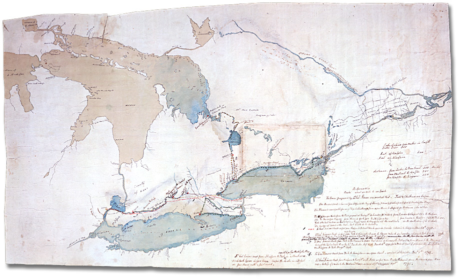
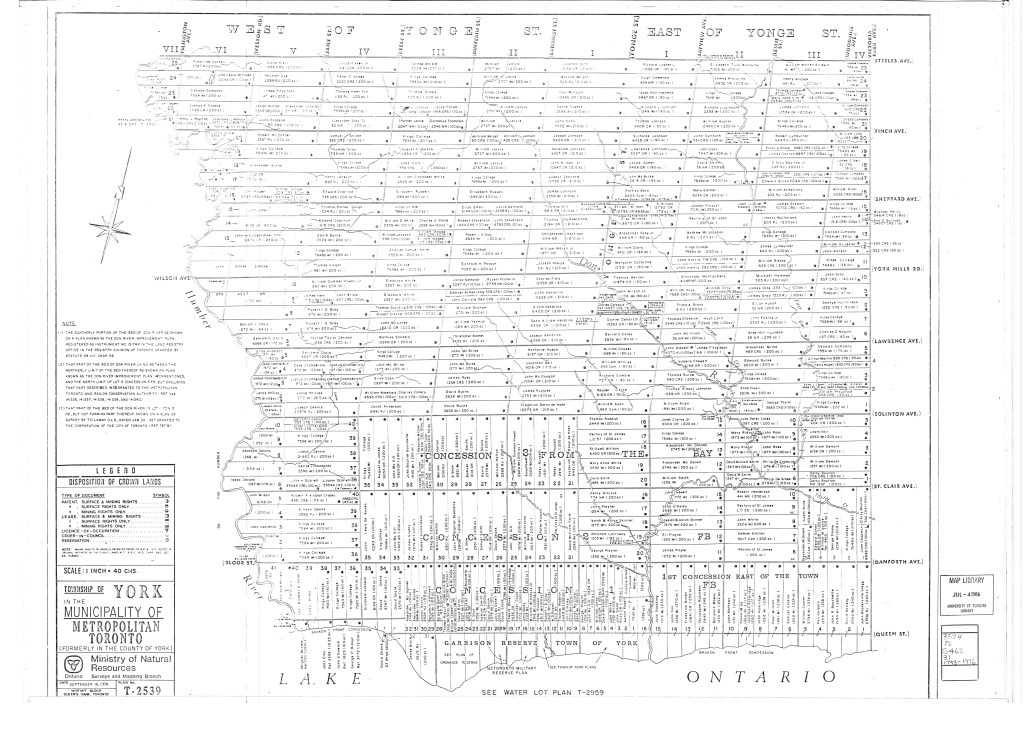
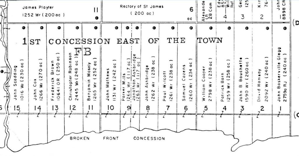
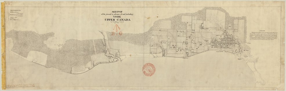
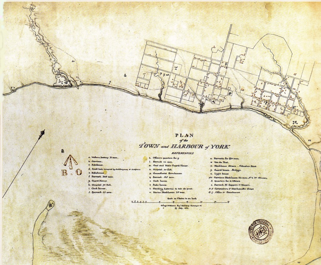
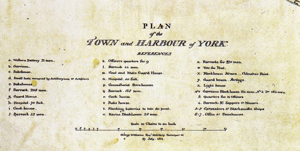
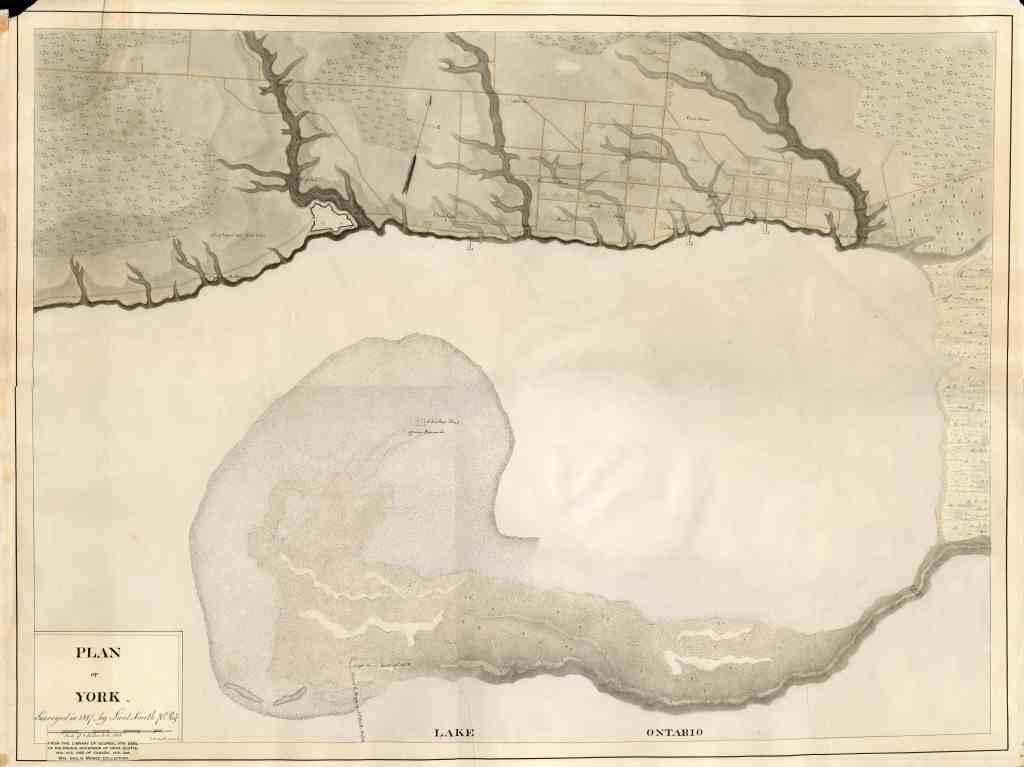
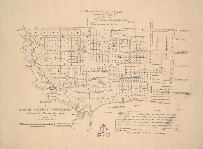
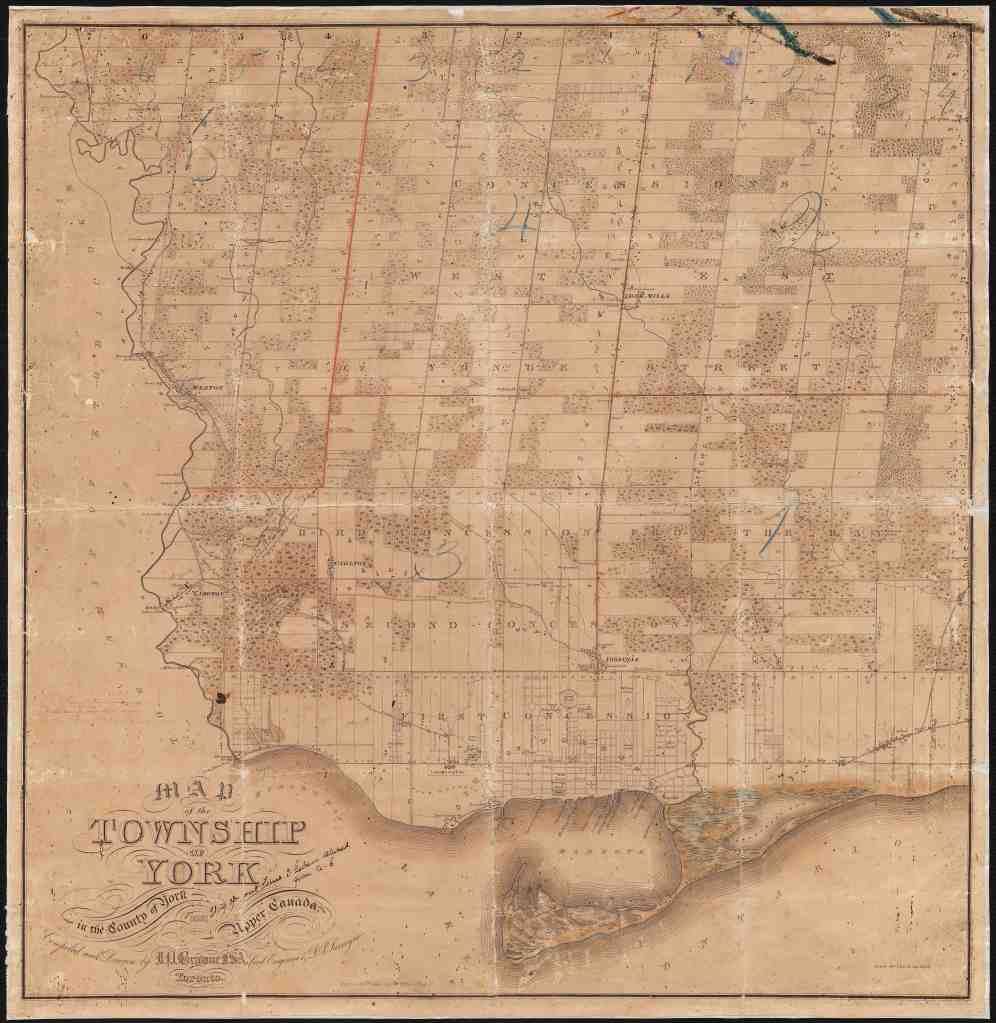
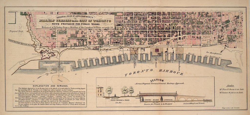
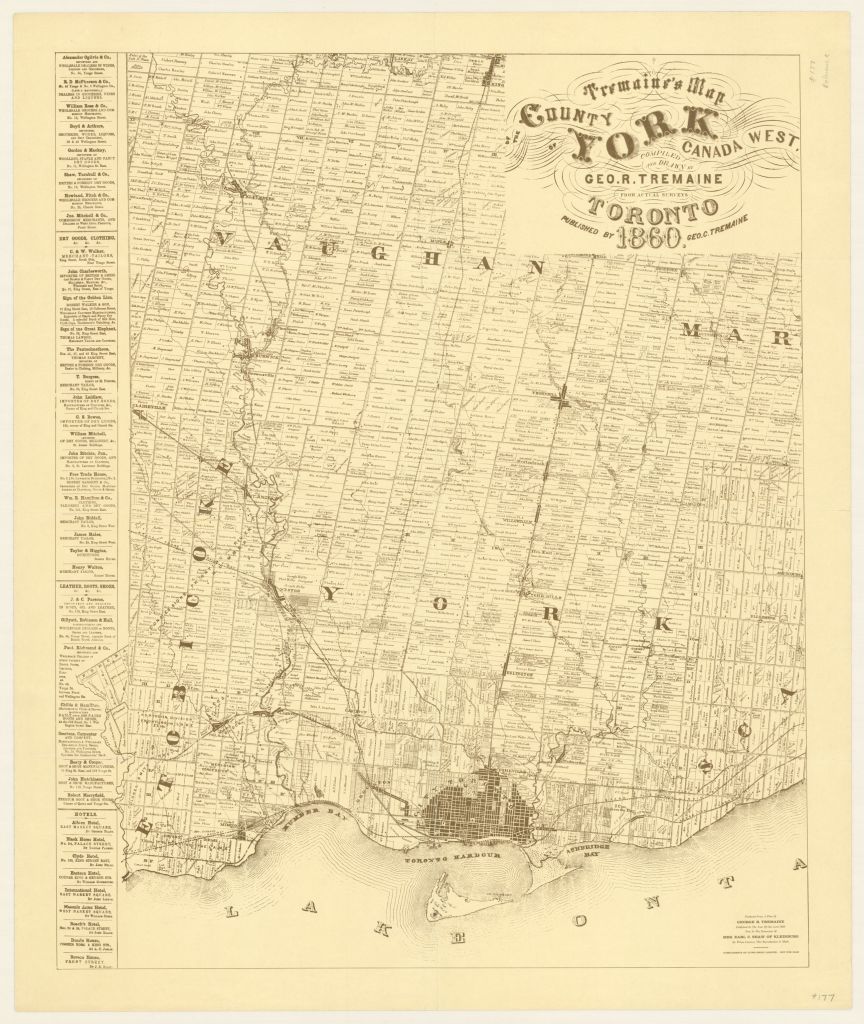
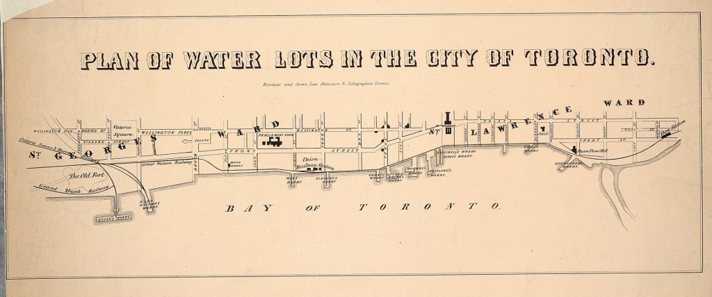
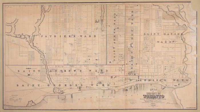
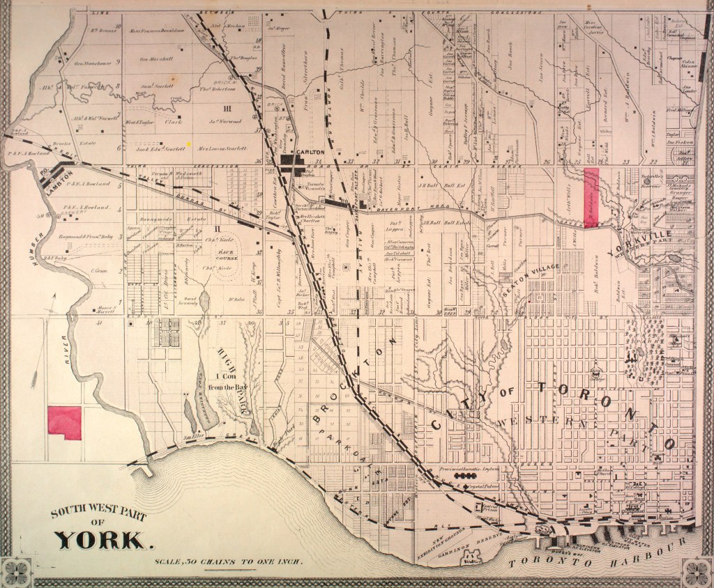
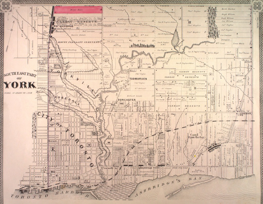
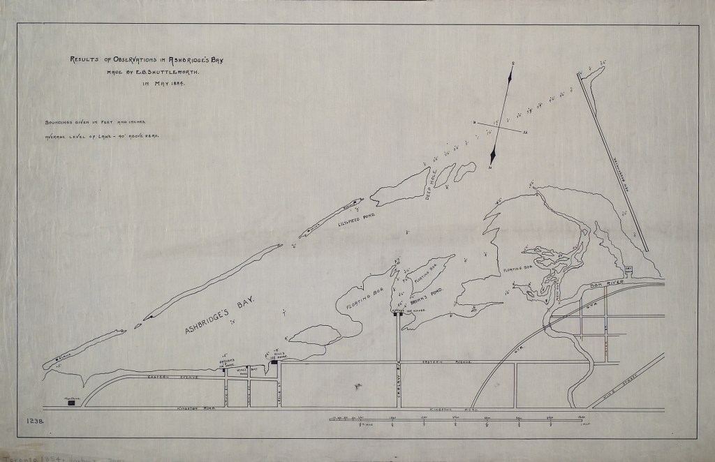
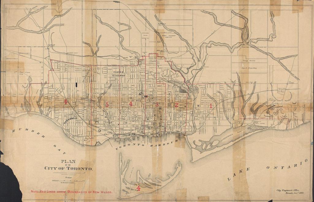
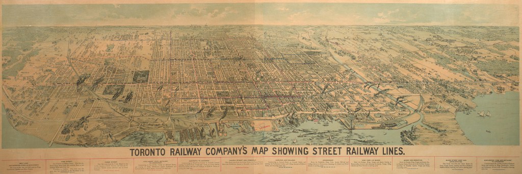
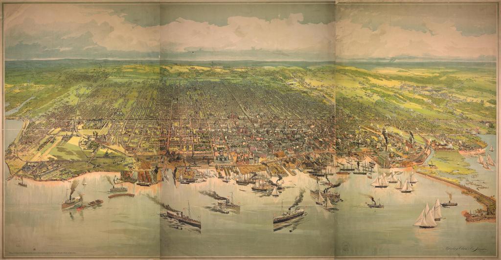
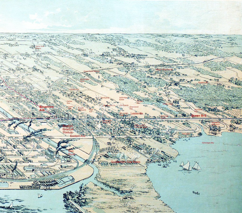
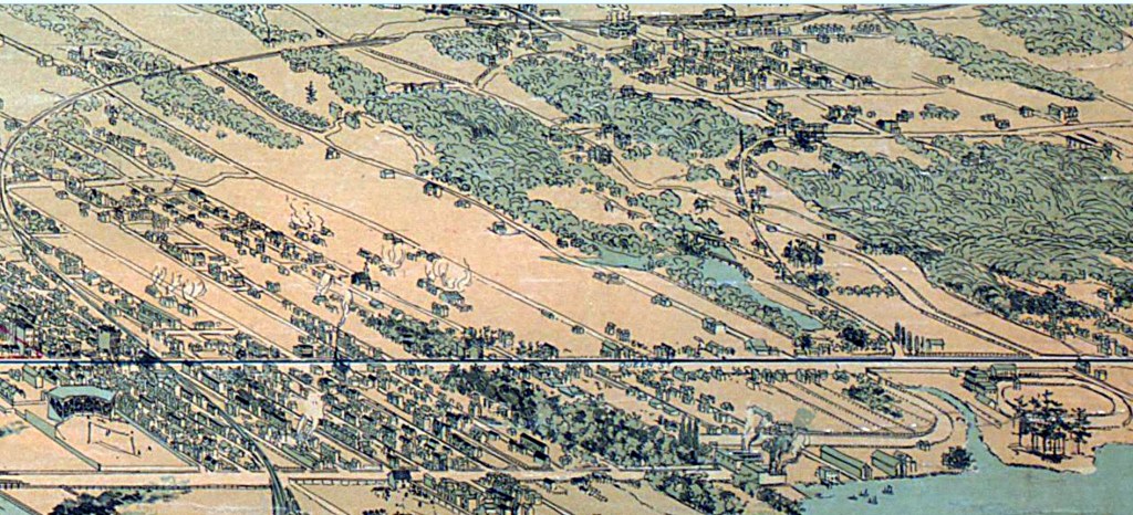
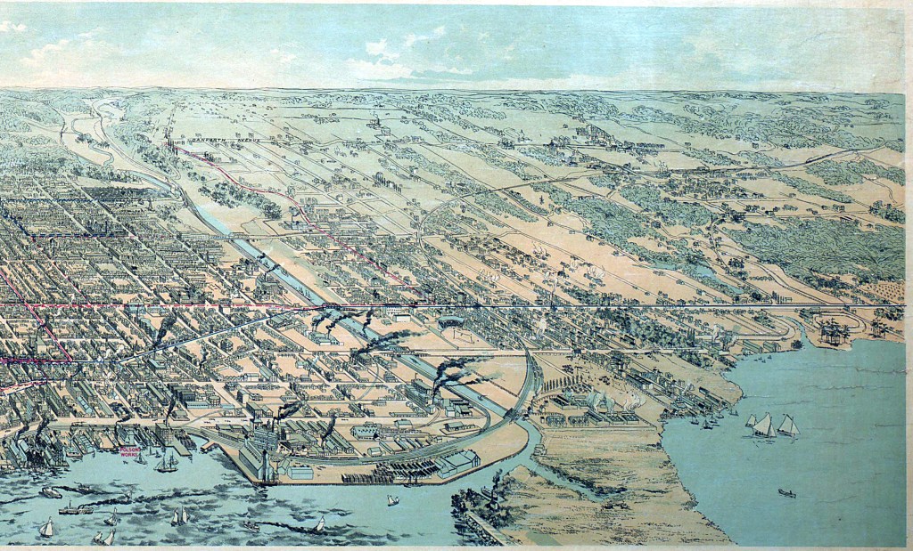
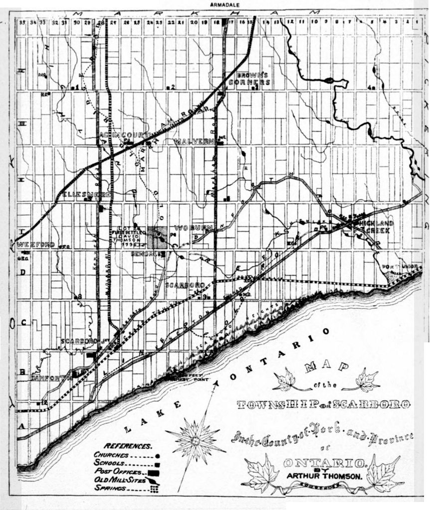
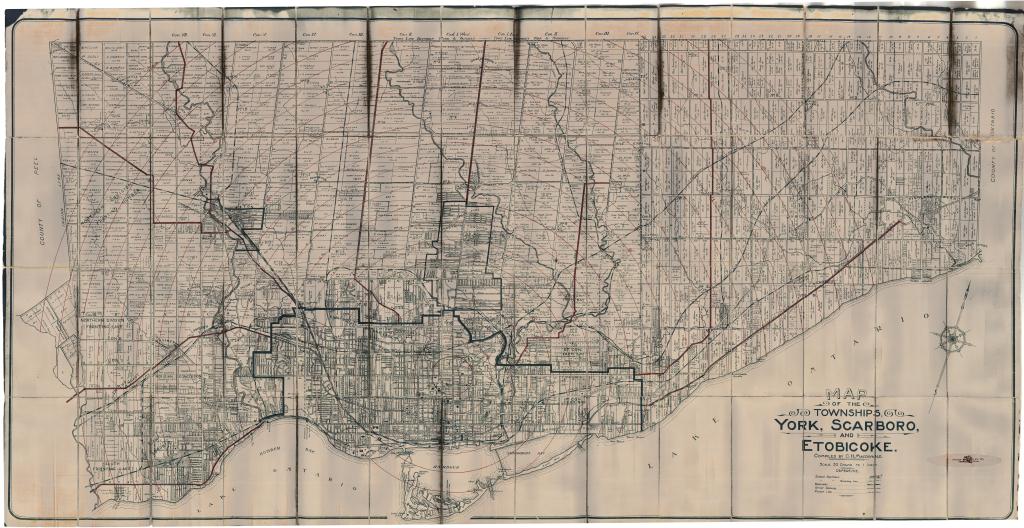
Maps, January 1868 Humber Bay by Lieut. Col. W.F. Drummond JervoisMaps, January 1868 Ashbridges Bay by Lieut. Col. W.F. Drummond JervoisDescription du pais des Hurons, 1651Map ascribed to Louis Jolliet (after 1673)Elizabeth Simcoe, Sketch map of Upper Canada, 1793-5Alexander Aitken, Plan of York Harbour, 1793Detail, Ashbridges Bay1796, Disposition of Crown land (land grants)Close up of land grants on Ashbridges BayMap, 1797, by Joseph BouchettePlan of the Harbour of York 18th day of Dec. 18101813 Sketch of the ground in advance of and including York, Upper CanadaMap, Toronto, July 1814Map, Toronto, July 1814 The KeyPlan of York. Surveyed in 1817 by Lieut. Smith 70th Regt. E. A. SmithNo. 1 plan of the town and harbour of York Upper Canada, October 31, 1833Henry James Castle, Plan of lands lately surveyed, adjacent to Toronto garrison, 1837 TPLEllis Browne map of York, 18511853 John J. Howard, General plan railway termini Toronto public walksTremaine’s map of the County of York, Canada West, 18601860 Plan of water lots in the city of Toronto.John O. (Owensworth) Browne, 1862 map of the City of TorontoCounty Atlas Map, 1878County Atlas Map, 18781885 map of Ashbridges Bay, by E. B. ShuttleworthPlan of the City of Toronto, 1892, City Engineer’s Office1892 Toronto Railway Company MapBarclay Clark, Chromolithograph of the City of Toronto, 1893Ashbridges Bay Improvement plan, 1893, E. H. Keating City Engineer1896 Arthur Thomson Map of ScarboroGoad’s Atlas, 1899Map by C. H. Macdonald, ca. 1909


Leave a comment